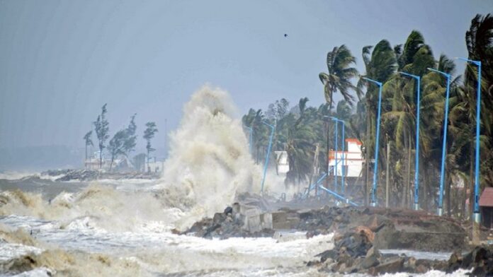
Cyclone Alert: Weather activity in the Arabian Sea may intensify in the coming days. A cyclonic circulation is persisting over the southeast Arabian Sea and the Comorin region. A trough is also active in the east and west directions.
According to a report by Skymet Weather, due to this, a low-pressure area is likely to form over the southeast Arabian Sea and the Lakshadweep region during the next 48 hours, which will soon become clearly marked. This impact may bring scattered to moderate rainfall to Tamil Nadu, Kerala, Rayalaseema, coastal Andhra Pradesh, and south interior Karnataka. Heavy rainfall may also occur in some areas.
Possibility of cyclonic storm
According to Skymet Weather, this low-pressure area could intensify into a depression over the south-central and southeast Arabian Sea by October 20th. Weather conditions are favorable for it to intensify further. Consequently, it is likely to develop into a cyclonic storm next week. However, its impact will not be felt in India. It will move towards the Somali coast and the Gulf of Aden. Whether or not it will become a storm will be determined only after the low-pressure area develops.
Heavy rains lash southern peninsula
With the entry of the northeast monsoon into southern peninsular India, heavy rainfall is continuing. Monsoon activity is expected to increase over the next few days. The Meteorological Department has issued a heavy rainfall alert for several areas. The India Meteorological Department (IMD) predicts heavy to very heavy rainfall at isolated places in Kerala, Tamil Nadu, and Puducherry over the next seven days.
केरल, तमिलनाडु और पुडुचेरी में कुछ स्थानों पर अगले 7 दिनों के दौरान भारी से बहुत भारी वर्षा के साथ वर्षा की गतिविधि में वृद्धि जारी रहने की संभावना है। pic.twitter.com/1XnJTnGBpa
— India Meteorological Department (@Indiametdept) October 16, 2025
How is the weather system of peninsular India?
The northeast monsoon is bringing heavy rainfall to southern Indian states. It has begun today (October 16) in Tamil Nadu, Puducherry and Karaikal, coastal Andhra Pradesh, Rayalaseema, south interior Karnataka, and Kerala-Mahe. An upper-air cyclonic circulation is persisting over the Comorin region and adjoining areas, extending up to the mid-tropospheric level. In the lower troposphere, easterly and northeasterly winds are prevailing over southern peninsular India and the south and adjoining central Bay of Bengal.
Rain continues in many states
uring the past 24 hours, moderate to heavy rainfall was recorded in Tamil Nadu, Puducherry, and Karaikal, and adjoining areas of South Coastal Andhra Pradesh and Kerala. Rainfall was also observed at a few places in Rayalaseema and adjoining areas of South Interior Karnataka. During the same period, heavy to very heavy rainfall was observed at isolated places in Tamil Nadu. According to Skymet Weather, light to moderate rainfall occurred in Kavali, Nellore, Parangipettai, Pamban, and Kanyakumari, while heavy rainfall was recorded in Tuticorin, Palakkad, and Cochin.


